DOC

‘Walk the Line’ Android application – supporting community groups and volunteers

The Department of Conservation (DOC) commissioned GBS to create an Android Mobile Application which enables DOC Rangers to navigate to traps and capture trap details. In 2013 DOC’s focus moved to working with communities, the Walk the Line application was seen as an opportunity to support community groups in trap monitoring. DOC decided to build a version of the Walk the Line application to run on the Android platform and ultimately decommission their Windows Mobile version of this application (which GBS also built).
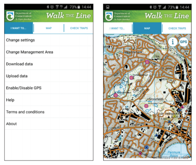
Walk the Line | Geographic Business Solutions

BACKGROUND

The original Windows Mobile Application met requirements for DOC staff but couldn’t be released to community groups without providing Windows Mobile devices and incurring significant
licensing costs.

The decision was made to build the Walk the Line application on Android. GBS built a proof of concept application replicating the workflows in the existing ArcGIS for Windows Mobile application to confirm the Android solution was appropriate and met the following requirements:

  1. Runs on Android Ice Cream Sandwich to Lollipop (4.0+)
  2. Works online and offline.
  3. Restricts community group users to the management areas
    they are responsible for.
  4. Licensing is either covered under DOC’s enterprise license
    agreement or is minimal in cost.
  5. Is easy to manage.
  6. Is easy to use.

GBS worked with DOC to build a solution that met these requirements.
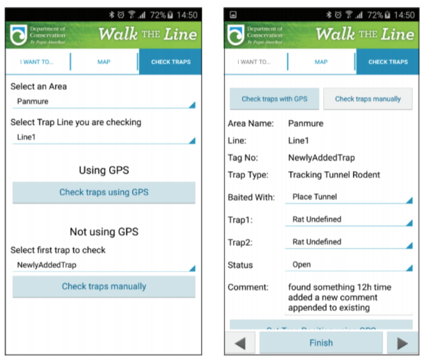
Walk the Line | Geographic Business Solutions

THE CHALLENGE

  • Licensing
  • Different users have access to different trap lines
  • The API
  • Synchronisation
  • Stability

THE TECHNOLOGY

This solution uses the following technology:
  • Esri Runtime SDK for Android version 10.2.8.
  • The solution integrates with Esri ArcGIS for Server 10.2.2+
    to work offline.
  • Mobile devices targeted are Android + – which are
    supported by the SDK.
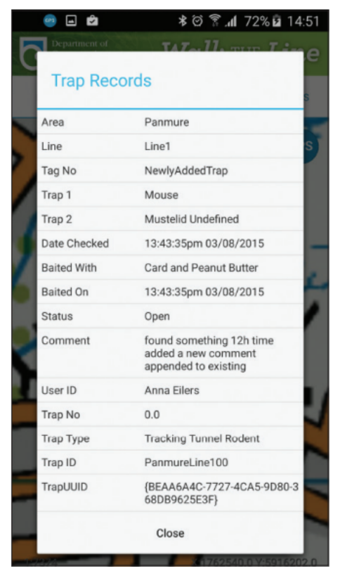
Trap Records | Geographic Business Solutions

KEY BENEFITS OF WALK THE LINE – ANDROID

Developing this tool allowed DOC to meet their objective of working with the community by providing community groups and volunteers with the ability to check traps and record the trap information in real time when online. Or, utilising offline functionality and synching edits when in a connected environment. There is no double handling of data, and the data captured meets DOC’s business rules and standards.

  • The Walk the Line – Android application enables users to;
  • Navigate to a pre-defined trap along a selected trap line
    by either using the GPS or using the map.
  • Efficiently capture trap information with relevant
    information as they ‘walk the line’.
  • Easily modify existing traps to update their location.
  • Define default attribute at the start of each transect line.
  • Sound an alarm when the community group member is
    in proximity of a trap.
  • Define their user specific settings.
  • Work online and offline with the ability to upload updates
    to the data when in a connected environment.
  • Easily download the data relevant to the specific user.

GBS-case-studies-logos-Esri-Partner-Network-image

Contact us to find out more