Products & Services

Our job is to solve your geospatial challenges

We’re your geospatial partner through every step of the process. Our tailored Esri-based GIS services and products ensure your business can operate faster and more efficiently. We’ll assist you to get the most out of your Esri platform with a holistic review and support approach.

GBS Consulting Services

We provide a range of consulting services, from technical advice, solution architecture, business analysis to high-level geospatial infrastructure strategies.

Our goal is to help you improve your return on investment in the Esri platform.

GBS Products

Our release ready products enable you to get more out of the Esri platform.
– Cityworks
– Edit+
– Portal for ArcGIS / ArcGIS Online Jumpstart Programme
– Portal for ArcGIS / ArcGIS Online Supercharge Programme
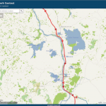
– Cable Harvest Planning Solution (CHPS)
– Automated Reporting Tool (ART)

GBS Support Programme

The GBS Support Programme (GSP) enables our customers to utilise our specialist Esri consultants and technicians to help ensure their GIS is delivering a high return on investment. The GSP is made up of:
GIS managed Services
– Support Services
– Advisory Services
– Application Hosting.

App configuration and development

Work with us to customise your Esri ArcGIS platform to meet your requirements and scale your business growth.

– Web mapping solutions is an important part of your location intelligence services.

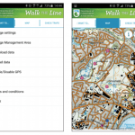
– Tailored Esri GIS solutions for mobile.

– GIS Desktop solutions to provide efficiency

Do you want better insight from your GIS? We offer tailored GIS Consulting Services

Our tailored geospatial services help you to achieve your business goals. We work closely work with your organisation to solve information management problems and implement location intelligence solutions based on your needs.

As an Esri Certified Gold Partner, you can be assured our Esri professional team is world class.

Talk to us about our core offering or see below to learn more about the benefits of our GIS Consulting Services.

Geospatial Consultancy Services to scale your business

HawkEye

Geospatial Solution Design & Architecture

  • Identify fit-for-purpose and future proofed GIS solutions specifically for your business or sector.
  • Transform your business data with location intelligence solutions designed and implemented by an experienced geospatial team.
  • With an expert team of Esri professional geospatial consultants your GIS architecture will always be best practice and scalable.


See how GBS worked with Ravensdown to design HawkEye >>

Web-based GIS Mapping Services

  • Developing GIS web mapping solutions is an important part of our location intelligence services.
  • We work with Esri’s ArcGIS Online and ArcGIS Enterprise utilising the ArcGIS Web AppBuilder and ArcGIS Experience Builder frameworks.
  • If customisation is required, we use APIs such as JavaScript/HTML5, .NET web services and JavaScript frameworks like Angular, React and Dojo.
  • We can automate using Webhooks, Notebooks, Attribute rules, ArcGIS Data Interoperability Extension, FME, and more.


Learn more about our Web Mapping Services and Solutions >>

GIS Mobile Solutions

  • Configuring solutions using Esri mobile tools such as ArcGIS Field Maps, ArcGIS Survey123, ArcGIS QuickCapture, and ArcGIS WorkForce
  • Tailored Esri GIS solutions for mobile – native apps using the Esri iOS, Android SDKs and .NET, and cross-platform apps using Xamarin and ArcGIS AppStudio.
  • Providing tools for GIS data management that allow data to be easily synchronised between master databases and mobile, offline and online.


See the benefits of GIS Mobile Development for DOC >>

GIS Desktop Solutions

  • Desktop solutions in ArcPro using .NET and Python development.
  • Desktop solutions in ArcMap using .NET and Python development.
  • Working with your team to provide additional GIS analytical capabilities.
  • Efficiency tools or dedicated desktop solutions such as CHPS.


See how we developed a GIS Desktop Solution for Forestry >>

GIS Strategy & Consulting

  • Strategic consulting and Esri technical advisory services.
  • Comprising specialist GIS Business Analysts and Project Managers, as well as Specialist Esri technicians, Data Scientists and GIS Analysts.
  • Providing ArcGIS Enterprise Upgrades and Implementations, and on-site placements to supplement and support your operational team.


Read more >>

Get in touch to discuss your requirements >>

Access your organisation’s information and improve efficiency using our targeted Geospatial Products

Gain insight into your organisation’s business data by utilising our products. From targeted ArcGIS Desktop efficiency tools, to enterprise geospatial products, we offer a solution that works for you.

Cityworks

  • Cityworks AMS is an Esri GIS centric asset management solution.
  • Cityworks AMS is designed to help organisations manage assets, their associated data, work activities, and business processes.
  • Leverage your investment in ArcGIS.


See how Cityworks can assist your organisation

Download the brochure >>

Click here for more information>>

Edit+

  • Bring the power of desktop GIS editing to your browser to make it easier for data owners to edit and manage their own spatial data.
  • Edit+ is an ArcGIS Web AppBuilder widget that brings advanced editing, including topology editing and error checking, to your browser.


See how Edit+ can benefit your organisation
Learn More here >>

Portal for ArcGIS / ArcGIS Online JumpStart Programme

  • Suited to any organisation wanting to quickly get started with ArcGIS Online whether you are new to Esri or have your own existing Esri infrastructure.
  • Be trained in the best practice for Portal for ArcGIS / ArcGIS Online at the same time as setting up and configuring your organisational account.
  • Maximise your ROI by ensuring your Portal for ArcGIS / ArcGIS Online subscription is operational in a timely manner.


Learn more about Portal for ArcGIS JumpStart
ArcGIS Online Jumpstart Programme >>

Portal for ArcGIS / ArcGIS Online SuperCharge Programme

  • Get the most out of your Portal for ArcGIS / ArcGIS Online subscriptions.
  • Combine your organisational knowledge of business process with our knowledge of Portal for ArcGIS / ArcGIS Online to identify opportunities.
  • Develop Portal for ArcGIS / ArcGIS Online templates to create re-usable templates tailored to your business needs.


Learn more about Portal for ArcGIS Supercharge
ArcGIS Online Supercharge Programme >>

product_chps

CHPS (Cable Harvest Planning Solution)

  • An ArcGIS Desktop forestry planning GIS tool to assist with steep terrain harvest planning.
  • Proven payload calculations for cable yarding
  • Fast and easy to use, with comprehensive reporting (maps, excel and PDF), online help and documentation
  • Reduce risk for forest managers and harvest contractors.


Check how CHPS can help with your harvest planning
Learn more here >>

Automated Reporting Tool (ART)

  • A web-based reporting solution with modern interfaces for report configuration and generation.
  • Generate a sophisticated Microsoft Word-based report that has been configured to collate multiple sources of information into one comprehensive output.
  • Applications include LIM processing, asset reporting, property-based reports and generic reporting.
  • Easily integrate your existing systems using APIs & leverage your ArcGIS Enterprise.
  • A quick and simple GIS efficiency tool for any organisation wishing to automate regular spatial reporting requirements.


Learn how ART can simplify your processing
View ART here >>

ARTImage

Are you ready to add long lasting value to your organisation?

If you need location-based intelligence solutions to transform your organisation, we invite you to share your challenges with us.