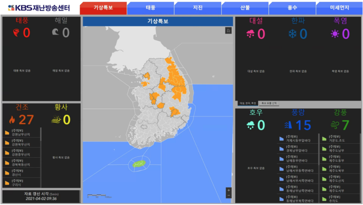
KBS Disaster Broadcasting Center
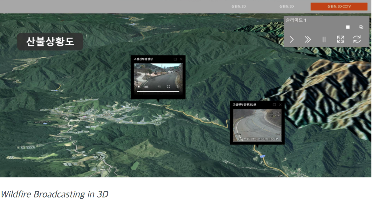
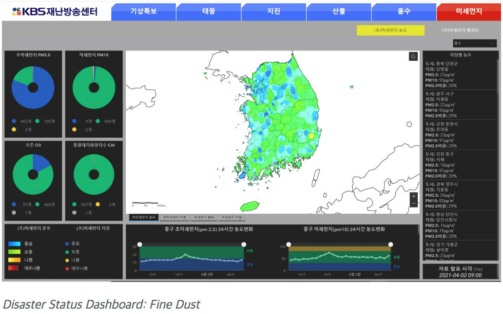
GBS Korea has built GIS contents that can update, visualise and use disaster information in real time for KBS Disaster Broadcasting Center.
Due to four very distinct seasons with various climate environments in Korea, preparation was needed for a variation of natural disasters such as typhoons, dust-contamination, wild fires and earthquakes. Therefore, weather prediction is key in order to reduce casualties and property losses, especially in hugely populated areas.