Engage and enable your users with Web Mapping
Talk to GBS about getting the most out of these 4 great components for a world-class web mapping solution.
Talk to GBS about getting the most out of these 4 great components for a world-class web mapping solution.
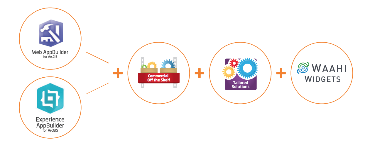
GBS offers highly configurable and extensible web mapping solutions based on our Waahi Widgets suite. These widgets are built on core Esri COTS tools and compatible tailored and custom add-ons. GBS’ web mapping widgets are designed to be easy to deploy and maintain, with highly intuitive user workflows.
Waahi Widgets offer the following key benefits:
| Internal or Public | Can be configured for either internal or public use including the ability to control security at different levels |
|---|---|
| Flexible deployment | Can be deployed on premise, in cloud (public/private) or hybrid environments |
| Enterprise Integration | Capabilities to connect your web mapping with associated information from other enterprise systems |
| Accessible on all devices |
Being specifically designed to be responsive to different platforms our solutions can be accessed on any iOS, Android or Windows smart device (tablet, mobile), desktop or web browser |
| Powered by ArcGIS Web AppBuilder and ArcGIS Experience Builder | Based upon Esri’s powerful frameworks in Experience Builder and Web AppBuilder, the solution allows you to easily deploy web mapping for any user, with the right data, tools and user experience to fit your needs, in line with Esri best practice |
| Fully configurable | Through the use of web-based administration tools our Widgets are designed to provide flexibility – eliminating the need for coding |

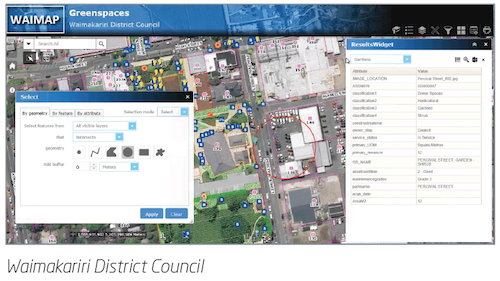
A range of highly functional widgets, configurable and extendable using Web AppBuilder and our supported Waahi Framework. Example widgets are:
Custom
COTS

![]()
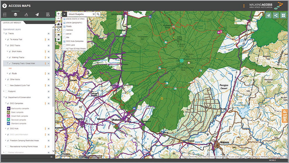
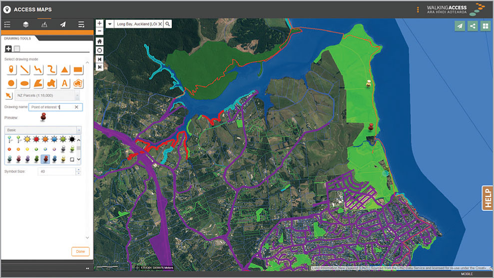 NZ Walking Access Commission – WAB + GISCO + GBS