In today’s complex business environment, effective asset management is crucial for organisations across many industries. Properly managing and maintaining assets not only ensures operational efficiency but also helps optimise resource allocation and reduce costs. Below we explore the critical role Geospatial Technologies plays in asset management and how it can unlock significant benefits for businesses.
Streamlining Asset Inventory and Documentation:
Geospatial Technologies provides a powerful platform for capturing, organising, and visualising asset data. By integrating location information with asset details, organisations can create comprehensive inventories and documentation. This allows for a holistic view of assets, facilitating better decision-making, and enabling efficient maintenance and replacement strategies.
Spatially Enabled Asset Tracking:
 Geospatial Technologies enables real-time tracking and monitoring of assets across different geographical locations. By leveraging GPS and other tracking technologies, organisations can visualise the current and historical locations of assets. This spatially enabled asset tracking capability enhances visibility and control, improving asset utilisation, reducing loss or theft, better maintenance of assets, and ensuring compliance with regulations.
Optimising Asset Maintenance and Repairs:
Geospatial Technologies helps organisations to optimise asset maintenance and repair schedules. By analysing spatial data, such as asset condition, age, location, and usage patterns, organisations can prioritise maintenance efforts. Geospatial Technologies-based asset management systems can generate alerts, work orders, and preventive maintenance schedules, ensuring timely inspections, repairs, and replacements. This proactive approach minimises downtime, extends asset life-cycles, and reduces overall maintenance costs.
Improved Risk Management and Resilience:
Geospatial Technologies provides valuable insights into asset vulnerabilities and risks. By overlaying spatial data, such as weather patterns, geological features, and infrastructure networks, organisations can assess potential risks to assets. This enables proactive planning for disaster response, identifying high-risk areas, and implementing mitigation strategies. GIS also aids in evaluating the impact of asset failures on critical operations, allowing organisations to develop resilient asset management strategies.
Enhanced Decision-Making and Collaboration:
Geospatial Technologies integrates asset data with other business information, enabling data-driven decision-making. By visualising asset locations, conditions, and performance metrics on maps, stakeholders gain a comprehensive understanding of asset portfolios. GIS-based dashboards and analytics empower organisations to analyse asset data, identify trends, and forecast future needs. This facilitates collaboration across departments and stakeholders, ensuring alignment and effective resource allocation.
Cost Savings and Efficiency Gains:
Geospatial Technologies-driven asset management streamlines workflows, reduces manual processes, and minimises redundant efforts. By optimising asset maintenance, reducing downtime, and improving asset utilisation, organisations can achieve significant cost savings. Furthermore, Geospatial Technologies facilitates efficient route planning, spatially optimised resource allocation, and improved field operations, leading to enhanced overall efficiency and productivity.
Geospatial Technologies serves as a powerful tool in asset management, delivering tangible benefits to organisations. By leveraging GIS, businesses can streamline asset inventory, track assets in real-time, optimise maintenance efforts, enhance risk management, and improve decision-making and collaboration. The integration of GIS with asset management processes leads to cost savings, increased efficiency, and improved operational resilience.
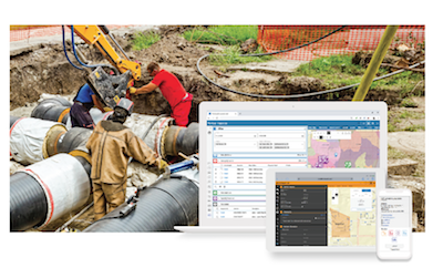
GBS understands the importance of Geospatial Technologies in asset management and is the exclusive NZ provider of Cityworks, a Trimble asset management system. Built exclusively on Esri® ArcGIS®, Cityworks helps you fully leverage your authoritative GIS data and provides a total solution to improve your agency’s operational effectiveness.
Our expertise and solutions empower organisations to unlock the full potential of GIS for effective asset management. To learn more about Cityworks and how our services can benefit your asset management strategies, get in touch with us to discuss your requirements.